Independently Owned, Locally Grown, Community Loved


A year after floodwaters tore through the Burdekin Shire, cutting roads, isolating communities and testing the resilience of the region, locals are reflecting not only on the scale of the disaster, but on the strength, cooperation and recovery that followed.
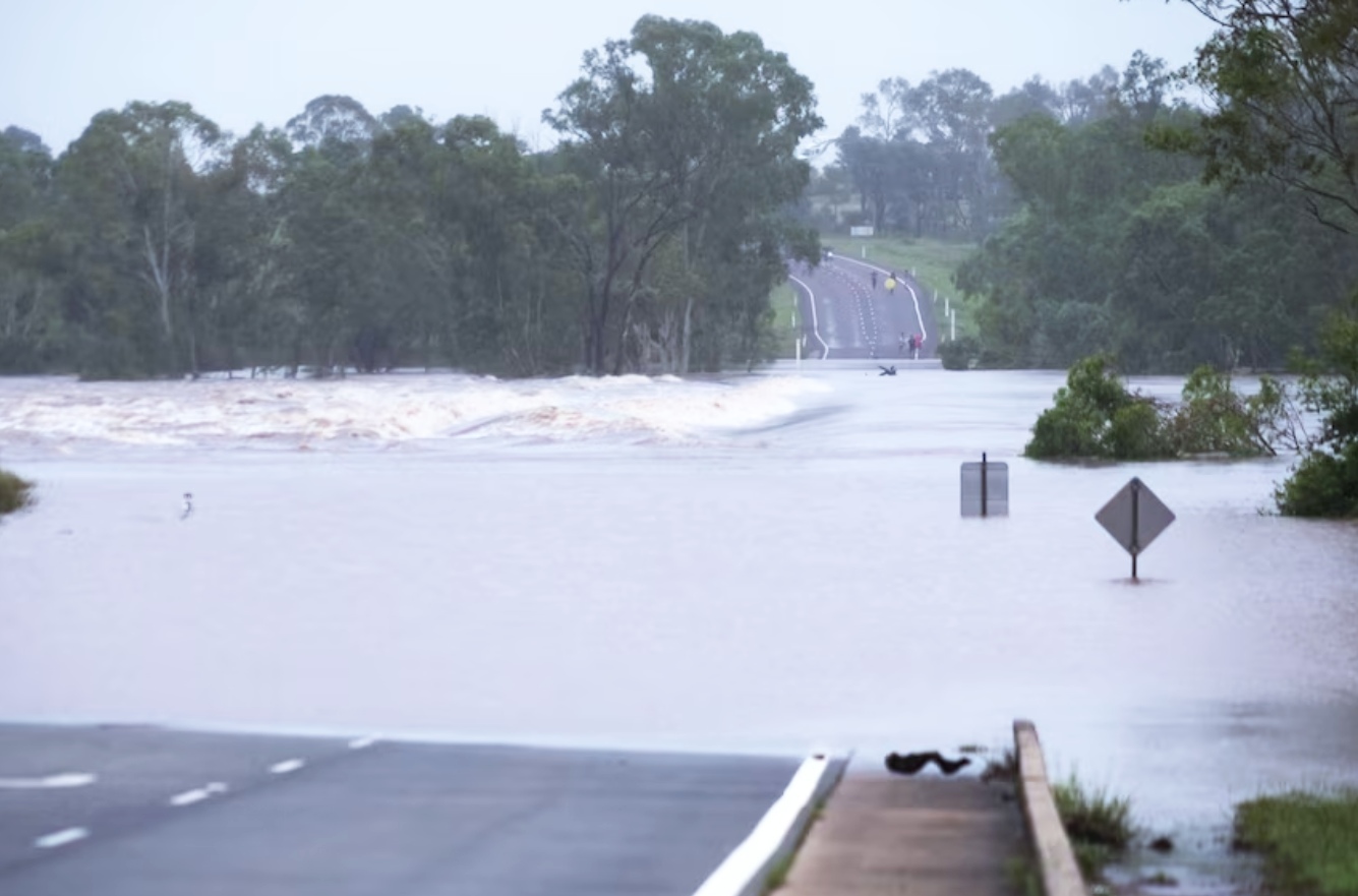
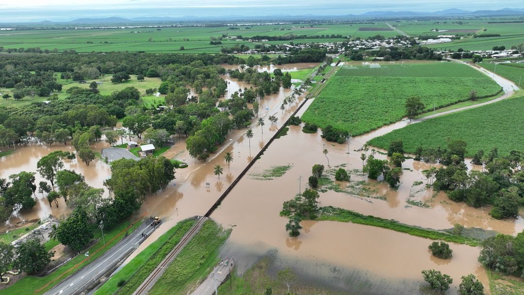
In early February 2025, days of torrential rainfall saw the Burdekin River surge to peak capacity, inundating roads and bridges and bringing traffic to a standstill across North Queensland. According to the Bureau of Meteorology, the event remains one of the most significant flooding events ever recorded in the Burdekin, alongside major floods in 1958, 1974, 1991, 2008, 2009 and 2019.
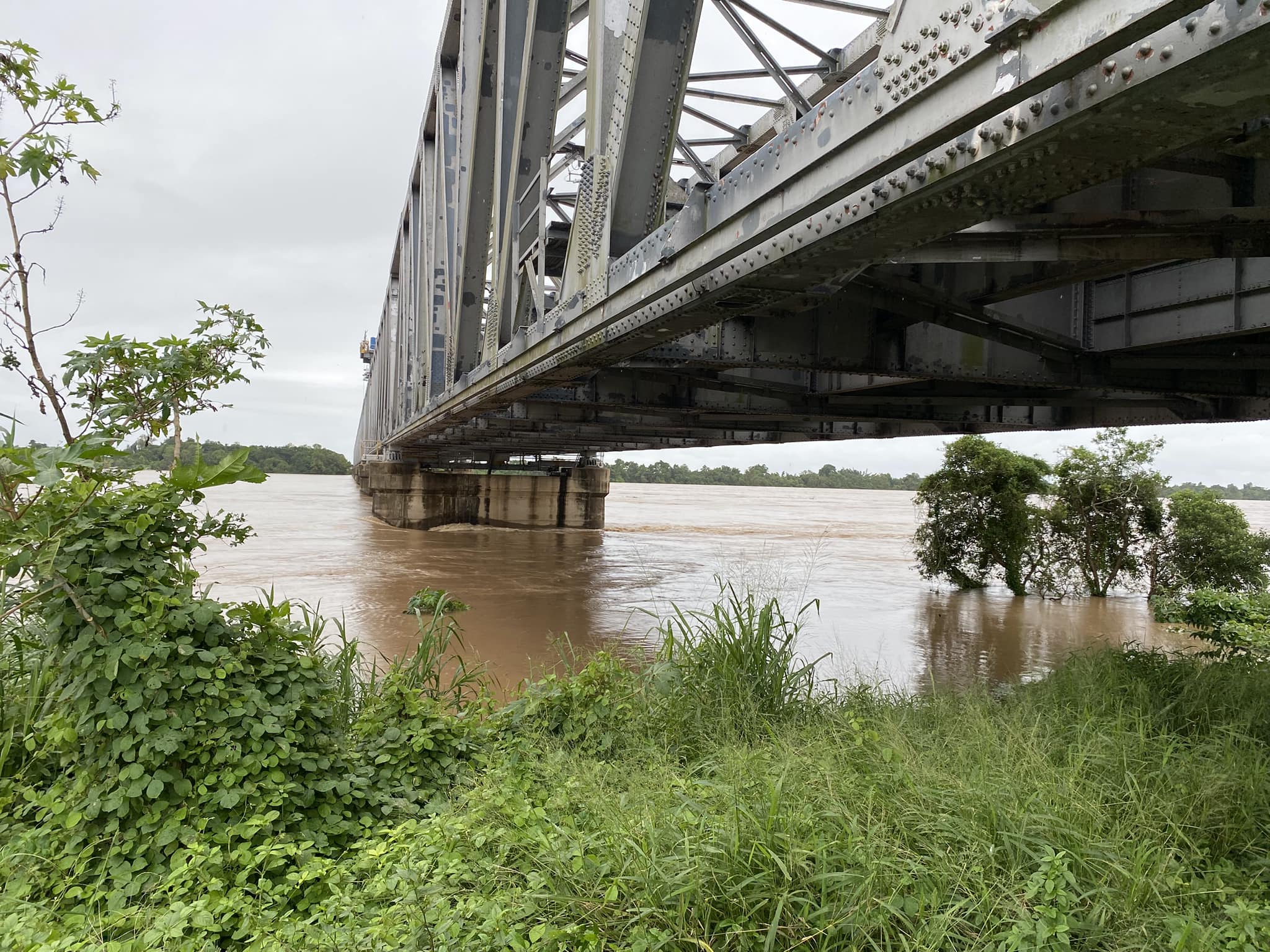
An active monsoon trough and multiple tropical lows produced prolonged heavy rainfall across northern Queensland, leading to major flooding throughout the upper and lower Burdekin River system. Water levels reached 19.27 metres at Sellheim on 3 February and peaked at 11.30 metres at Inkerman Bridge on 12 February.
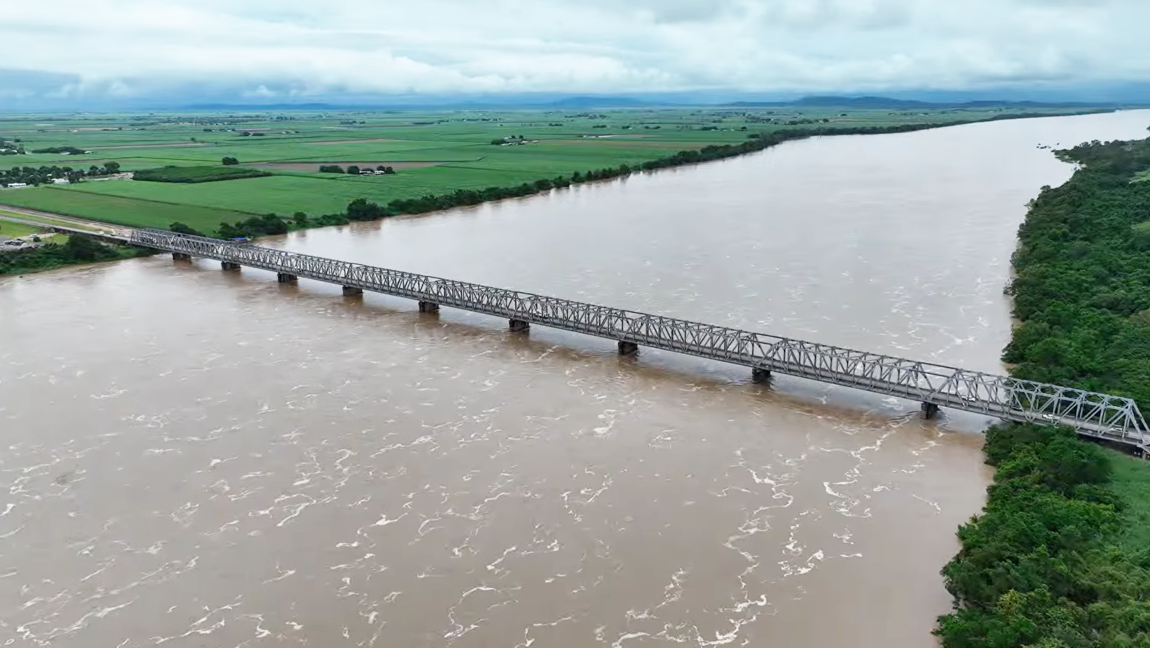
The Burdekin River basin drains a vast catchment of around 130,000 square kilometres, with floodwaters converging from the Burdekin and Belyando rivers before flowing past Ayr and Home Hill and into the sea. Downstream of the Burdekin Falls Dam, communities experienced flooding caused by both upstream flows and intense rainfall below the dam; a combination that left Ayr and Home Hill particularly vulnerable.
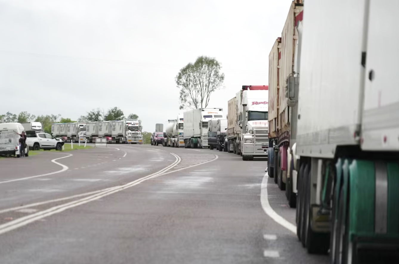
Road closures quickly followed, including the Bruce Highway at Plantation Park, the Macrossan Bridge on the Flinders Highway, and multiple regional roads linking Giru, Rita Island and Clare. Charters Towers was temporarily cut off, freight ground to a halt and long queues of trucks stretched up to three kilometres on either side of the river crossings.
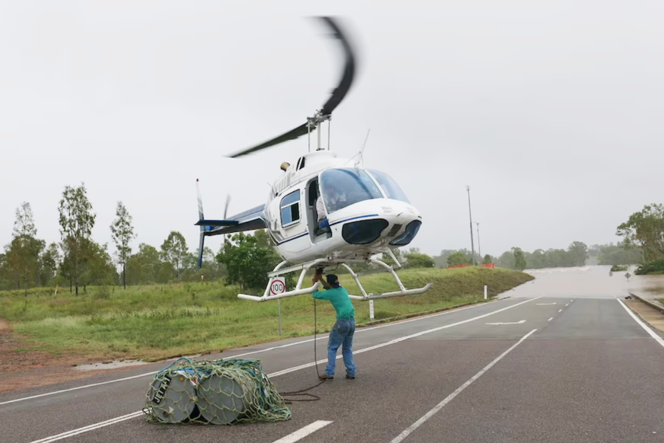
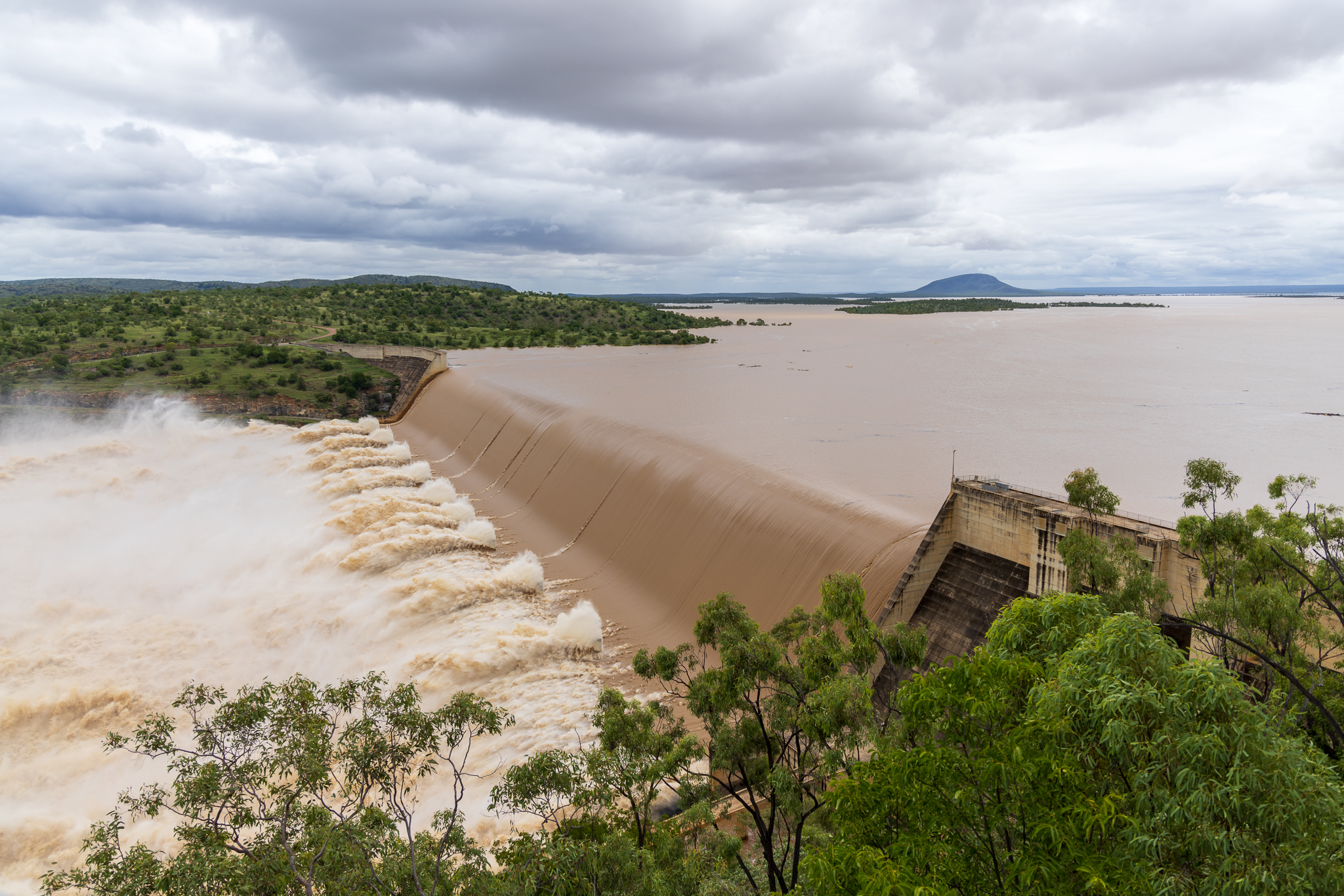
As conditions worsened, emergency services carried out swift water rescues, helicopters were used to transport stranded motorists, and essential supplies were flown across floodwaters to isolated communities. Residents were urged to monitor conditions closely as the Burdekin Falls Dam spilled excess water, reaching more than 200 per cent capacity at its peak.
At the height of the event, major flood warnings were issued across multiple river systems, while residents in the Lower Burdekin region were advised to prepare five days’ worth of food, water and medication as renewed rises remained possible.
Despite the widespread disruption, coordination between emergency services, councils and community groups proved critical.
“The LDMG (Local Disaster Management Group) consists of multiple different agencies including Council members who have all been working tirelessly, and in collaboration, to support as best we can for the disaster event. The impact of this event extends beyond the Burdekin, affecting the broader North Queensland region and presenting unique challenges,” Burdekin Shire Mayor Pierina Dalle Cort said.
“The LDMG is monitoring conditions and are well prepared to act or respond accordingly. As the LDMG has many experienced people, they are assisting to deliver favourable outcomes for the community.
“I urge all residents to stay informed through official sources, including the Burdekin Disaster Dashboard (disaster.burdekin.qld.gov.au). Please continue to follow safety advice, check on your neighbours, and reach out if you need assistance,” Mayor Pierina Dalle Cort added.
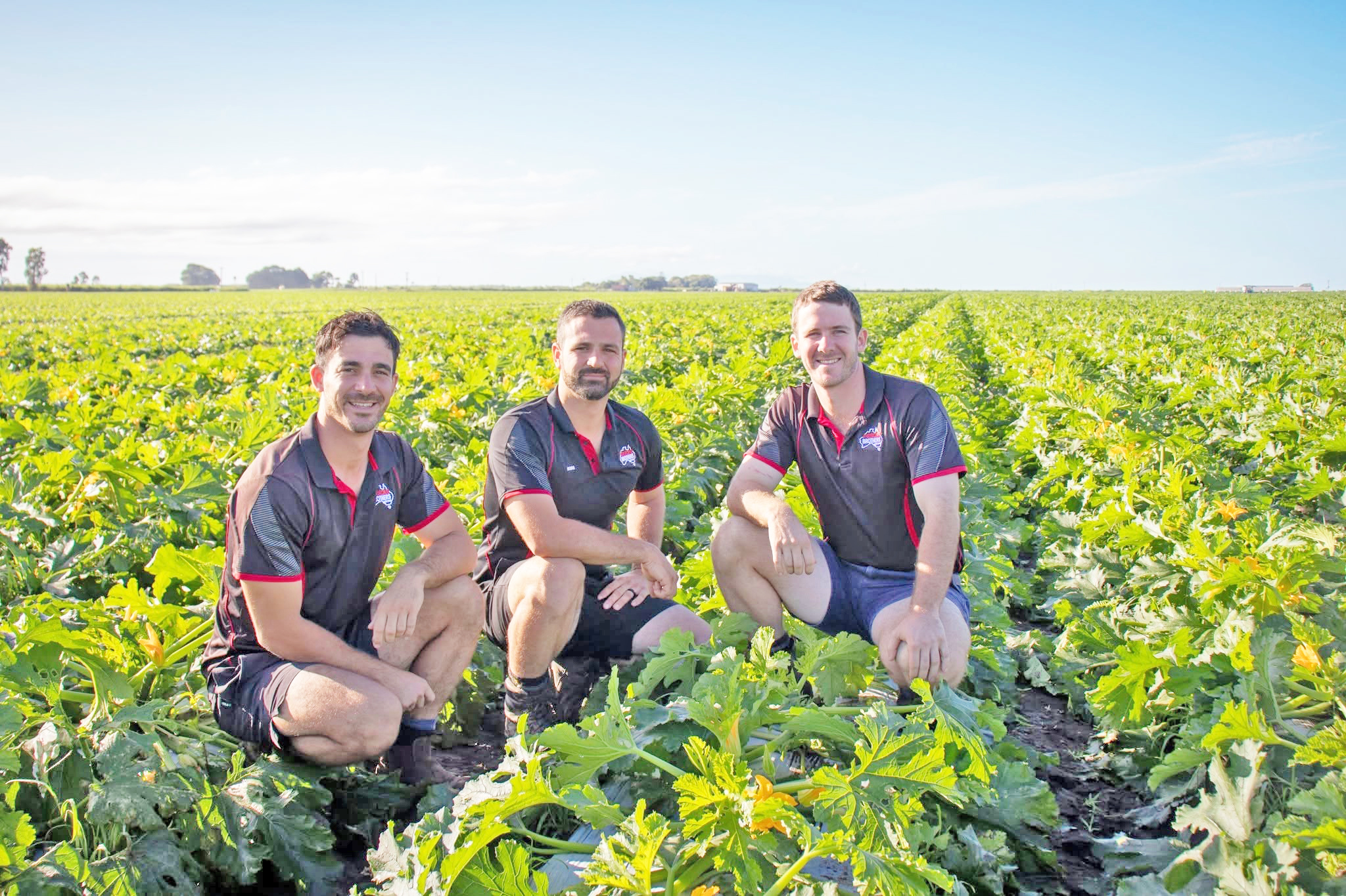
Schools shifted to skeleton staffing or online learning, hospitals reorganised services, including transporting dialysis patients by rail, and farmers worked around the clock to save livestock and infrastructure. The kindness of residents shone brightly as several locals opened their hearts to support stranded truckies offering refuge and free warm meals to those in need.
Records show that Ayr has experienced 10 major floods since 1911, with the most recent before 2025 occurring in 1991 when the river reached 12.53 metres at Inkerman Bridge. While those levels were not exceeded in 2025, the intensity of rainfall and volume of water moving through the system placed extraordinary pressure on the region.
Just weeks later, the recovery phase was already underway.
By late March 2025, 95 per cent of small and family businesses across the Burdekin had reopened, supported by joint State and Commonwealth Disaster Recovery Funding Arrangements. Grant assistance was doubled from $25,000 to $50,000, with additional funding directed toward tourism recovery and regional marketing.
“We promised no daylight between response and recovery, and it’s pleasing to see a significant amount of work has already been undertaken to get many small and family businesses back on their feet,” Minister for Small and Family Business Steve Minnikin said.
A year on, the Burdekin stands as a powerful example of regional resilience, shaped by floodwaters, but defined by community spirit, preparedness and determination.
While memories of submerged highways, roaring rivers and isolated towns remain vivid, so too does the collective effort that carried the region through one of the most challenging chapters in its history.

Publishers Indemnity. Any individual or entity that places advertising, supplies copy material, or submits editorial content to Core Life Publishing agrees and undertakes to ensure that all such material:- Does not infringe upon any copyright, trademark, or other intellectual property rights;- Is free from any content that could be considered defamatory, libelous, or slanderous;- Does not infringe upon any rights related to privacy or breach of confidence;- Contains no obscene, indecent, or otherwise unlawful material;- Complies fully with the Trade Practices Act and all other applicable laws, regulations, or statutes.Furthermore, by submitting or placing such material, these individuals or entities agree to indemnify and hold harmless the publisher, Core Publishing and Events Pty Ltd, and/or its agents from and against any and all investigations, claims, demands, liabilities, damages, costs, or judgments arising out of or in connection with the material provided. All material is believed to be accurate at the time of printing and remains the copyright of Core Publishing and Events Pty Ltd.
© 2026 Life Publishing Group Pty Ltd.