Independently Owned, Locally Grown, Community Loved
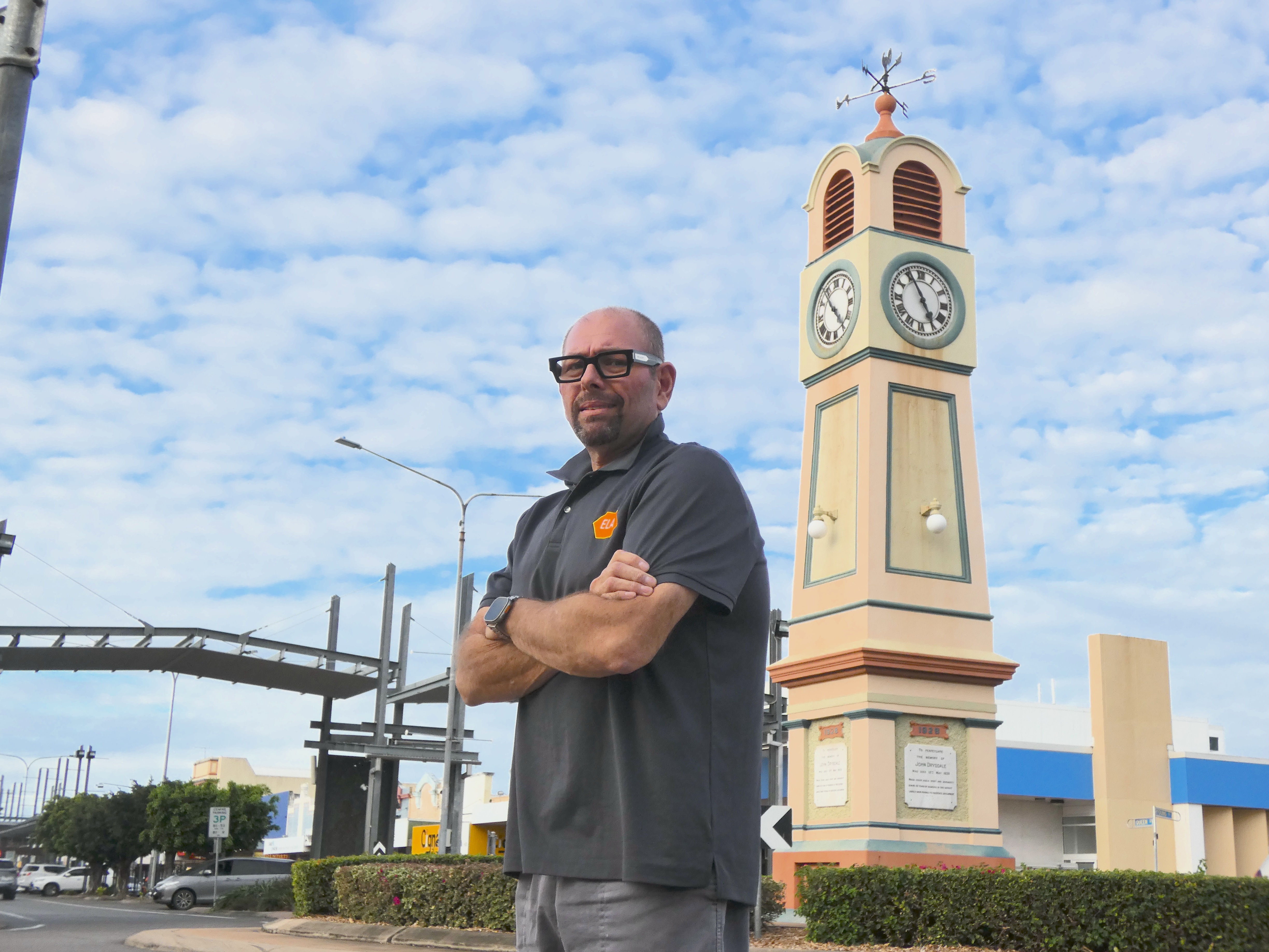
Outgoing president Eusebio Aguirre (pictured) is urging the community to step up and “help save the region’s business community”. Photo: Jacob Casha. A shortage of willing leaders has pushed the Burdekin Chamber of Commerce to the brink, with the longstanding business organisation calling a crisis meeting in a final bid to secure its future and preserve a key voice for the region’s business community. CHAMBER CALLS FOR NEW LEADERS AS CLOSURE LOOMS The Burdekin Chamber of Commerce has sounded the alarm, calling a public crisis meeting in an effort to keep the longstanding organisation from folding. The move follows the resignation of its last remaining executive members, leaving every position vacant ahead of the organisation’s Annual General Meeting (AGM) in September. In keeping with its bylaws, if a president, secretary and treasurer do not step up by the AGM in a month’s time, the organisation will cease to operate. The Chamber’s demise would spell the end of a decades-long legacy of business advocacy in the region. Its annual Burdekin Christmas Street Party has also become a beloved fixture on the Burdekin calendar, with the organisation estimating it generated more than $2 million for local businesses last year. As one final throw of the dice, the Chamber has announced an open crisis meeting at the Queens Hotel in Ayr at 5.30pm Thursday 6th of August. Led by outgoing president and owner of ELA Solutions Eusebio Aguirre, alongside other former executive members, the meeting will outline each vacant role in a bid to drum up interest and fill the positions on the night. Mr Aguirre said the meeting was open to all local business houses, urging the community to step up and “help save the region’s business community.” “I’m worried,” Mr Aguirre said. “We’ve built [the Chamber] up to be such a great thing—and for what? “We just need people with passion to step in. We can’t let it fold.” Mr Aguirre admitted that these were not uncharted waters for the organisation, which held a crisis meeting three years ago for almost identical reasons. The positions were ultimately filled after a small group of business owners, including Mr Aguirre himself, made a pact on the night to take charge of the organisation. After fulfilling his three-year term as president, he hopes next month’s meeting can produce a similar outcome. “We all made a pact—‘if you do it, I’ll do it’. Then, more and more came onboard … everyone was talking about it, and it snowballed into something amazing,” Mr Aguirre said. “That’s what we’re hoping will happen this time.” If the Burdekin Chamber folds, it would follow a North Queensland trend which has also seen Charters Towers and Hughenden lose their respective Chambers of Commerce. Mr Aguirre said the irony of the crisis was that it was not driven by financial distress. He said the new committee would inherit a “very financially viable” organisation which had increased its membership by almost 100 over the past year. The organisation has also maintained strong attendance across its monthly workshops and networking meetings. However, Mr Aguirre said the membership support alone was not enough to save the Chamber. He urged anyone interested in taking on an executive role to attend the 6th of August meeting at the Queens Hotel to learn more. CAPTION: The Chamber-led State of the Region Roadshow breakfast drew a strong crowd outside Wild East in May. Photo: Jacob Casha.


Publishers Indemnity. Any individual or entity that places advertising, supplies copy material, or submits editorial content to Core Life Publishing agrees and undertakes to ensure that all such material:- Does not infringe upon any copyright, trademark, or other intellectual property rights;- Is free from any content that could be considered defamatory, libelous, or slanderous;- Does not infringe upon any rights related to privacy or breach of confidence;- Contains no obscene, indecent, or otherwise unlawful material;- Complies fully with the Trade Practices Act and all other applicable laws, regulations, or statutes.Furthermore, by submitting or placing such material, these individuals or entities agree to indemnify and hold harmless the publisher, Core Publishing and Events Pty Ltd, and/or its agents from and against any and all investigations, claims, demands, liabilities, damages, costs, or judgments arising out of or in connection with the material provided. All material is believed to be accurate at the time of printing and remains the copyright of Core Publishing and Events Pty Ltd.
© 2026 Life Publishing Group Pty Ltd.


-p-2000.jpg)