
Independently Owned, Locally Grown, Community Loved

By Chelsea Ravizza
Residents across North Queensland took the opportunity this week to solemnly reflect on one of the worst weather events ever recorded in the state, as communities marked the 15th anniversary of Cyclone Yasi.
On 29 January 2011, Cyclone Yasi developed from a tropical low north-west of Fiji before rapidly intensifying as it tracked west across the Coral Sea. The system was officially named by the Fiji Meteorological Service on 30 January and was upgraded to a Category 5 tropical cyclone on 2 February. Yasi crossed the coast near Mission Beach in the early hours of Thursday, 3 February 2011 before weakening to a tropical low near Mount Isa later that evening.
As the Burdekin Shire braced for impact, local authorities stepped up efforts to support the community. Reports published at the time of the disaster detailed Burdekin SES volunteers responding to countless calls, delivering 400 sandbags filled with 30 tonnes of sand to residents ahead of the system. SES Volunteers recall feelings of anticipation ahead of the event, noting their readiness to respond and support the community.
Authorities in the region, including fire and ambulance crews, experienced a dramatic increase in calls, reporting that on 1 February alone, officials received 500 calls from concerned residents, with several needing to be redirected to the Burdekin Shire Council call centre.
Schools across North Queensland remained closed as the weather continued to intensify, while businesses across the district also closed shop, preparing for what was to come as the system edged closer.
Several Groper Creek residents recall casting a line despite deteriorating conditions in the lead-up to Cyclone Yasi’s landfall, with some locals prioritising the opening of the barra season over seeking shelter.
After making landfall on 3 February, the cyclone’s eye passed over Dunk Island and Mission Beach, delivering destructive winds across a wide section of the North Queensland coast between Cairns and Townsville, directly impacting the Burdekin, Cassowary Coast, and Hinchinbrook.
In the midst of the system, strong winds, currents and waves caused significant erosion along the eastern region of the Burdekin Delta, comparable to the impacts of 1971’s Cyclone Althea, prompting officials to conduct studies focusing on the Paluma Shoals – a section heavily influenced by Burdekin River flood plumes – well into 2014. A Bureau of Meteorology (BOM) report detailed the Burdekin River catchment experienced major flooding, with new river height records set at Macrossan Bridge and on the Haughton River, as the Burdekin River peaked at 18.47 metres on 4 February 2011.
Cyclone Yasi caused widespread devastation across the region, with Ergon Energy reporting 28,000 customers within the Burdekin Shire were left without power. Across North Queensland, more than 170,000 customers were affected, with some communities waiting up to a month for electricity to be fully restored.
Rosemary Menkens, 2011 Member for Burdekin applauded the Burdekin Shire Council’s response to Cyclone Yasi, commending the community on their resilience and preparedness.
“Cyclone preparation is a necessity in North Queensland, but the local disaster management groups really come into their own when cyclones threaten,” Menkens said.
“In the lead-up to Cyclone Yasi, the Burdekin Shire Council set in motion the local disaster management group to bring key agencies together to plan for eventualities and to minimise exposure of residents to any harm or loss of infrastructure.”
An estimated $300 million loss to agricultural production, particularly affecting banana and sugarcane growers across the state was recorded, with insured losses reaching approximately $1.4 billion, eclipsing the damage bill left behind by Cyclone Larry in 2006. In total, the Federal Government processed more than $250 million in recovery payments, with concessional loans made available to cyclone-affected farmers. In the weeks and months that followed, the state government continued to deliver waves of support, including grants totalling up to $25,000 per delivery to primary producers and business owners within the region.
15 years later, the legacy of Cyclone Yasi continues to shape disaster preparedness both locally and statewide, while standing as a testament to the strength and resilience of North Queensland communities.
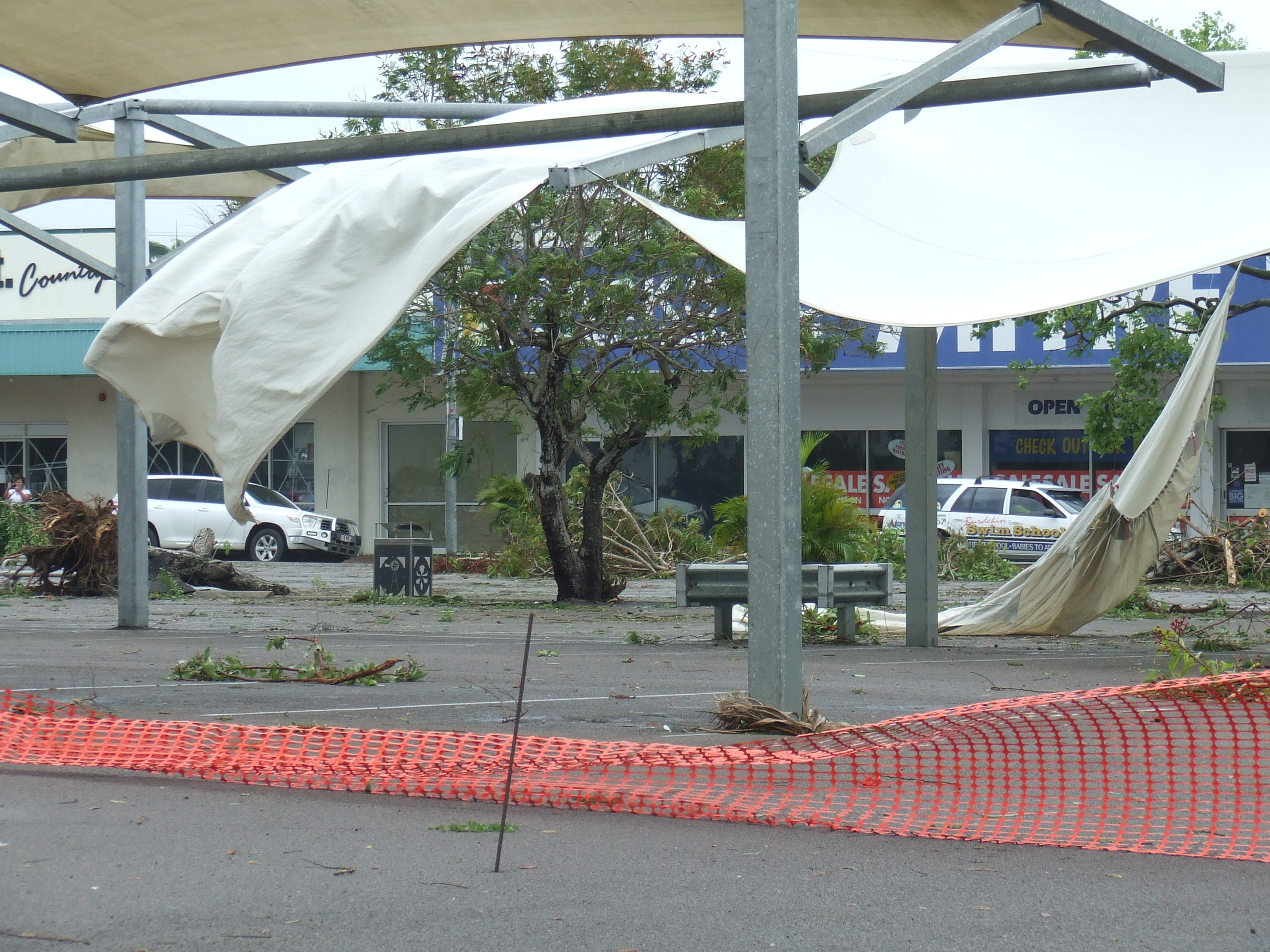
Woolworths car park on Queen Street was ravaged. Photo source: Burdekin Library
Queen Street was littered with debris. Photo source: Burdekin Library
Authorities were dispatched across the North to communities in need. Photo source: QPS
Cardwell felt the brunt of the system. Photo source: QPS
Flooding across the Bruce Highway left the Burdekin isolated. Photo source: QPS
Rolled semis left the Bruce Highway cut. Photo source: QPS
Trees were uprooted across the region. Photo source: QPS
Crops were ravaged, especially banana plantations in Tully. Photo source: QPS
Businesses boarded up doors and windows to minimise damage. Photo source: Facebook
Publishers Indemnity. Any individual or entity that places advertising, supplies copy material, or submits editorial content to Core Life Publishing agrees and undertakes to ensure that all such material:- Does not infringe upon any copyright, trademark, or other intellectual property rights;- Is free from any content that could be considered defamatory, libelous, or slanderous;- Does not infringe upon any rights related to privacy or breach of confidence;- Contains no obscene, indecent, or otherwise unlawful material;- Complies fully with the Trade Practices Act and all other applicable laws, regulations, or statutes.Furthermore, by submitting or placing such material, these individuals or entities agree to indemnify and hold harmless the publisher, Core Publishing and Events Pty Ltd, and/or its agents from and against any and all investigations, claims, demands, liabilities, damages, costs, or judgments arising out of or in connection with the material provided. All material is believed to be accurate at the time of printing and remains the copyright of Core Publishing and Events Pty Ltd.
© 2026 Life Publishing Group Pty Ltd.


.jpg)
.jpg)